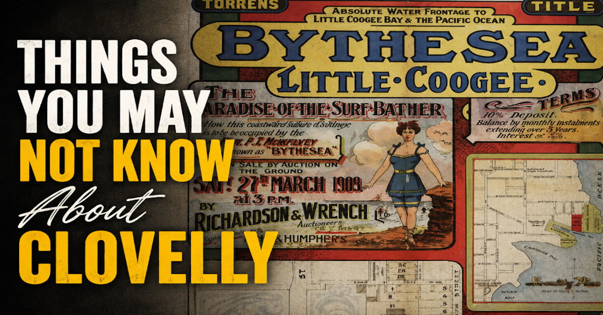
Before it became Clovelly, this pocket of Sydney’s eastern coastline was called Little Coogee. It has also been known as “Poverty Point”, was once dominated by a castle-like mansion and nearly had a road built across the mouth of its bay.
Today, Clovelly is one of Sydney’s best-known seaside suburbs, built around its narrow sandstone cove and swimming culture.
But behind the beach, concrete promenades and tightly held homes is a history that looks very different from the Clovelly locals know today.
Here are five things you may not know about the suburb.

1. Clovelly Used to Be Called Little Coogee
For years, the area now known as Clovelly was called Little Coogee, after the larger Coogee Beach further south beyond Gordon’s Bay.
The name survived into the early 20th century, but the arrival of better public transport created a problem.
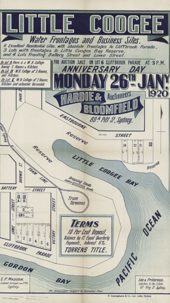
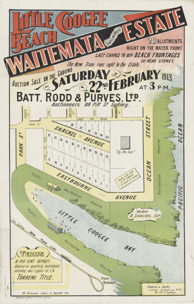
Subdivision had gathered pace by 1909 and the local progress association was pushing for the tramway to be extended to the growing neighbourhood. The tram line was eventually completed in 1913.
With trams now travelling to both Coogee and Little Coogee, local residents wanted to remove the potential for confusion.
The Little Coogee Progress Association held a naming competition in 1914. Its president, F H Howe, suggested Clovelly, after the fishing village of the same name in Devon, England.
It won.
Another popular contender was Eastbourne. Although it failed to become the suburb’s name, it survives today in Eastbourne Avenue.
2. Clovelly Was Once Known as ‘Poverty Point’
It is difficult to reconcile with modern Clovelly property prices, but the area was once known locally as “Poverty Point”.
Longtime resident Linda McIntosh recalled the nickname when speaking about her childhood in Clovelly for Randwick City Council’s Local Legends oral history project.
She remembered taxi drivers picking up her mother after shopping in Bondi and, on occasion, being reluctant to take the family to Clovelly because they feared passengers at the destination might not pay their fares.
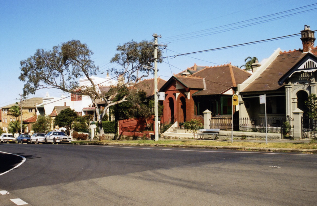
Early Clovelly was certainly more modest than the suburb of today.
Homes initially clustered around Northumberland, Campbell and Boundary streets. Further west, some houses in Greville Street incorporated sandstone quarried around nearby Knox and Fewings streets.
3. A Castle-Like Mansion Once Dominated the Area
One of Clovelly’s most remarkable buildings has completely disappeared.
In 1834, William Charles Greville, a clerk in the Colonial Secretary’s Office, paid £40 for 20 acres of beachfront land at Little Coogee Cove. Greville Street later took his name.
The land subsequently passed through several owners.
Dr John Dixon built a mansion called Rock Brook, surrounded by elaborate gardens. The property later passed to John Campbell, George Renwick and then newspaper proprietor Samuel Bennett.
Bennett incorporated the earlier house into the much grander Mundarrah Towers, an imposing castellated residence that became a local landmark.
It survived until 1926, when it was demolished as suburban development transformed Clovelly. Mundarrah Towers made way for another enduring local institution: the Clovelly Hotel.
4. There Were Plans for a Causeway Across Clovelly Bay
Clovelly’s concrete platforms are now an inseparable part of the beach, but their history stretches back to public works undertaken during the Great Depression.
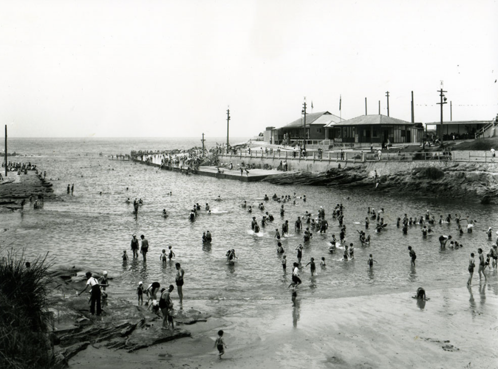
The projects provided employment for local men while improving access around the cove.
The plans were ambitious.
The concrete platforms were intended to be connected by a causeway across the mouth of the bay, suitable for motor traffic and designed to make it easier for bathers to move around the foreshore.
It was never completed as planned.
A severe storm in 1938 destroyed the causeway project and the idea was abandoned.
Remnants can still be exposed at low tide, while the surviving underwater structures have effectively become a reef-like habitat.
5. Shark Point Was Once Part of Sydney’s Coastal Defences
The swimmers, walkers and sightseers around Clovelly’s headlands today occupy a coastline that once had a very different purpose.
Shark Point was fortified from 1879, forming part of wider efforts to strengthen Sydney’s coastal defences during a period of concern about possible attack by foreign powers, including Russia.
Fortifications were positioned along strategic parts of the coastline from the approaches around Botany Bay towards Sydney Harbour and South Head.
It means a place now associated overwhelmingly with swimming and recreation once had a role in the defence of Sydney.
From Little Coogee to ‘Cloey’
Other remnants of Clovelly’s past are scattered throughout the suburb.
A public infants school was operating from the Church of England Mission Hall in Varna Street by 1897, with Eliza McDonnell teaching an average attendance of 76 pupils. Clovelly Public School officially dates from 1913, when permanent accommodation was provided in Arden Street.
Surf lifesaving also became an important part of the suburb’s identity. Clovelly Surf Life Saving Club was formed in 1907.
One of the most significant events in its early history occurred on 5 December 1927, when five young men became trapped by a rising tide at Schnapper Rocks. More than 30 lifesavers took part in the rescue. Four were saved, but 19-year-old Thomas Wooldridge drowned. Randwick City Council records the event as the “Rescue off Schnapper Rocks”.
Clovelly even once had its own cinemas. The Clovelly Kings Cinema closed in 1959 as television changed entertainment habits. It later became the Clovelly RSL before most of the building was demolished for apartments, with its distinctive ocean-liner-style façade retained.
From Little Coogee to “Poverty Point” and eventually the Clovelly affectionately known as “Cloey”, the suburb has undergone several transformations.
Much of the old Clovelly has vanished, but its history remains visible in its street names, sandstone, shoreline — and in the name the suburb eventually chose for itself.
Published 11-Aug-2026